Hemel Hempstead
| Hemel Hempstead | |
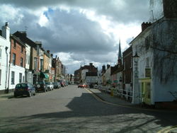
 Hemel Hempstead Old Town |
|
 Hemel Hempstead
|
|
| Population | 81,143 |
|---|---|
| OS grid reference | |
| District | Dacorum |
| Shire county | Hertfordshire |
| Region | East |
| Country | England |
| Sovereign state | United Kingdom |
| Post town | HEMEL HEMPSTEAD |
| Postcode district | HP1, HP2, HP3 |
| Dialling code | 01442 |
| Police | Hertfordshire |
| Fire | Hertfordshire |
| Ambulance | East of England |
| EU Parliament | East of England |
| UK Parliament | Hemel Hempstead |
| List of places: UK • England • Hertfordshire | |
Hemel Hempstead is a town in Hertfordshire in the south east of England, 27 miles (43.5 km) to the north west of London. The population at the 2001 Census was 81,143 (but now estimated at around 89,000 by Hertfordshire County Council).
Developed after World War II as a new town, it has existed as a settlement since the 8th century and was granted its town charter by King Henry VIII in 1539. It is part of the district (and borough since 1984) of Dacorum and the Hemel Hempstead constituency.
History
Origin of the name
The settlement was called by the name Henamsted or Hean-Hempsted, i.e. High Hempstead, in Anglo-Saxon times and in William the Conqueror's time by the name of Hemel-Amstede.[1] The name is referred to in the Domesday Book as "Hamelamesede", but in later centuries it became Hamelhamsted. In old English, "-stead" or "-stede" simply meant a place, such as the site of a building or pasture, as in clearing in the woods, and this suffix is used in the names of other English places such as Hamstead and Berkhamsted.[2]
Another opinion is that Hemel probably came from "Haemele" which was the name of the district in the 8th century and is most likely either the name of the land owner, or could mean "broken country".[3][4]
The town is now known to residents as "Hemel" however before The Second World War locals called it "Hempstead".
The town may have given its name to the town of Hempstead, New York. Immigrants from Hemel Hemstead migrated to the area which is now Hempstead, New York, including the surrounding areas such as Roosevelt, in the late 17th century.[5]
Early history
Remains of Roman villa farming settlements have been found at Boxmoor and Gadebridge which span the entire period of Roman Britain.
The first recorded mention of the town is the grant of land at Hamaele by Offa, King of Essex, to the Saxon Bishop of London in AD 705.
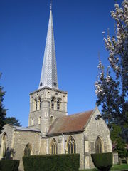
Hemel Hempstead on its present site is mentioned in the Domesday Book of 1086 as a vill, Hamelhamstede, with about 100 inhabitants. The parish church of St Mary's was built in 1140, and is recognised as one of the finest Norman parish churches in the county. The church features an unusual 200 feet (61 m) tall spire, added in the 12th century, one of Europe's tallest.
After the Norman conquest the land thereabouts was given to Robert, Count of Mortain, the elder half-brother of William the Conqueror, as part of the lands associated with Berkhamsted Castle. The estates passed through many hands over the next few centuries including Thomas Becket in 1162. In 1290 King John of England's grandson, the Earl of Cornwall, gave the manor to the religious order of the Bonhommes when he endowed the monastery at Ashridge. The town remained part of the monastery's estates until the Reformation and break-up of Ashridge in 1539.
In that same year, the town was granted a Royal charter by King Henry VIII to become a Bailiwick with the right to hold a Thursday market and a fair on Corpus Christi Day. The first Bailiff of Hemel Hempstead was William Stephyns (29 December 1539). The King and Anne Boleyn are reputed to have stayed in the town at this time.[6]
Unusually fine medieval wall paintings from the period between 1470 and 1500 were discovered in some cottages in Piccotts End, very close to Hemel Hempstead in 1953. This same building had been converted into the first cottage hospital providing free medical services by Sir Astley Cooper in 1827.[7]
In 1581, a group of local people acquired lands — now referred to as Box Moor — from the Earl of Leicester to prevent their enclosure. These were transferred to trustees in 1594. These have been used for public grazing and they are administered by the Box Moor Trust.
Hemel's position on the shortest route between London and the industrial Midlands put it on the Sparrows Herne turnpike Toll road in 1762, the Grand Junction Canal in 1795 and the London and Birmingham Railway in 1837.[8] However it remained principally an agricultural market town throughout the 19th century. In the last decades of that century development of houses and villas for London commuters began. The Midland Railway built a branch line connecting to its mainline at Harpenden in 1877 (see The Nicky Line). Hemel steadily expanded, but only became a borough on 13 July 1898. During World War II 90 high explosive bombs dropped on the town by the Luftwaffe. The most major incident was on 10 May 1942 when a stick of bombs demolished houses at Nash Mills killing 8 people. The nearby Dickinson factories which were used to produce munitions and were the target.[9]
New town
After World War II, in 1946, the government designated Hemel Hempstead as the site of one of its proposed New Towns designed to house the population displaced by the London Blitz, since slums and bombsites were being cleared in London. On 4 February 1947, the Government purchased 5,910 acres (23.9 km2) of land and began work on the "New Town". The first new residents moved in during April 1949, and the town continued its planned expansion through to the end of the 1980s. Hemel grew to its present population of 80,000, with new developments enveloping the original town on all sides. The original part of Hemel is still known as the "Old Town".

Hemel Hempstead was announced as candidate No 3 for a New Town in July 1946, in accordance with the government's "policy for the decentralisation of persons and industry from London". Initially there was much resistance and hostility to the plan from locals, especially when it was revealed that any development would be carried out not by the local council but by a newly appointed government body, the Hemel Hempstead Development Corporation (later amalgamated with similar bodies to form the Commission for New Towns). However, following a public inquiry the following year, the town got the go-ahead. Hemel officially became a New Town on 4 February 1947.
The initial plans for the New Town were drawn up by architect G. A. Jellicoe. His view of Hemel Hempstead, he said, was “not a city in a garden, but a city in a park.” However, the plans were not well-received by most locals. Revised, and less radical plans were drawn up, and the first developments proceeded despite local protests in July 1948. The first area to be developed was Adeyfield. At this time the plans for a double "magic" roundabout at Moor End were first put forward, but in fact it was not until 1973 that the roundabout was opened as it was originally designed. The first houses erected as part of the New Town plan were in Longlands, Adeyfield, and went up in the spring of 1949. The first new residents moved in early 1950.
At this time, work started on building new factories and industrial areas, to avoid the town becoming a dormitory town. The first factory was erected in 1950 in Maylands Avenue. As building progressed with continuing local opposition, the town was becoming increasingly popular with those moving in from areas of north London. By the end of 1951, there was a waiting list of about 10,000 wishing to move to Hemel. The neighbourhoods of Bennett's End, Chaulden and Warner's End were started. The Queen paid a visit shortly after her accession in 1952, and laid a foundation stone for a new church in Adeyfield — one of her first public engagements as Queen. The shopping square she visited is named Queen's Square, and the nearby area has street names commemorating the then-recent conquest of Everest, such as Hilary and Tenzing Road. This conquest is also celebrated in the name of a pub in Warners End – the 'Top of the World'.
The redevelopment of the town centre was started in 1952, with a new centre based on Marlowes south of the old town. This was alongside a green area called the Water Gardens, designed by Jellico, formed by ponding back the River Gade. The old centre of the High Street was to remain largely undeveloped, though the market square closed and was replaced by a much larger one in the new centre. The former private estate of Gadebridge was opened up as a public park. New schools and roads were built to serve the expanding new neighbourhoods. New housing technology such as prefabrication started to be used from the mid-50s, and house building rates increased dramatically. Highfield was the next neighbourhood to be constructed. The M1 motorway opened to the east in 1959, and a new road connecting it to the town was opened.
By 1962, the redevelopment of the new town as originally envisaged was largely complete, though further expansion plans were then put forward. The nearby United States Air Force base of Bovingdon, which had served as the town's de facto airport, closed at this time, though private flying continued for a further seven years. Dacorum College, the library, new Police station and the Pavilion (theatre and music venue) were all built during the 1960s. The town seemed to attract its fair share of celebrity openings, with shops and businesses opened by Frankie Vaughan, Benny Hill, Terry-Thomas, and the new cinema was opened by Hollywood star Lauren Bacall. The last of the originally-planned neighbourhoods, Grovehill, began construction in 1967. However, further neighbourhoods of Woodhall Farm and Fields End were later built as part of the extended plans.
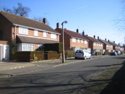
Like other first generation new towns, Hemel is divided into residential neighbourhoods, each with their own "village centre" with shops, pubs and services. Each neighbourhood is designed around a few major feeder roads with many smaller cul-de-sacs and crescents, intended to minimise traffic and noise nuisance. In keeping with the optimism of the early postwar years, much of the town features modernist architecture with many unusual and experimental designs for housing. Not all of these have stood the test of time. A significant issue was how to choose names for all the new roads. Many areas of the new town used themes e.g. fields, birds, rivers, poets, explorers, leaders, etc.
In the 1970s, the government abolished the Borough of Hemel Hempstead and the town was incorporated into Dacorum District Council along with Tring and Berkhamsted. The first chairman of that council was Chairman John Johnson (1913–1977). In the 1980s, Dacorum District Council successfully lobbied to be recognised as the successor for the Royal Charter establishing the Borough of Hemel Hempstead and thus regained the Mayor and its Aldermen and became Dacorum Borough Council. The political atmosphere of the town has changed significantly. Once a Labour Party stronghold, the town has seen an increase in Conservative Party voting in recent years, and the current Member of Parliament, Mike Penning, is Conservative.
As of the 2001 census, Hemel Hempstead is the most populated urban area in Hertfordshire, narrowly more populated than its traditionally "larger" rival, Watford.
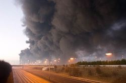
Europe's largest peacetime explosion
At 6am on Sunday 11 December 2005 there was a major explosion in the town at the Hertfordshire Oil Storage Terminal, Buncefield. (See 2005 Hertfordshire Oil Storage Terminal fire). This was one of the largest explosions ever to occur in the UK, and put Hemel briefly in the headlines with the incident being described as the biggest of its kind in peacetime Europe.[10]
The Maylands Avenue industrial estate was severely damaged and much of it needed to be demolished. Nearby residential districts of Adeyfield, Woodhall Farm, Highfield and Leverstock Green were also badly damaged and around 300 people were made temporarily homeless. 41 people sustained minor injuries and two were seriously hurt. It is believed that the only reason that no one was killed was because the explosion occurred before dawn on a Sunday.
Geography
 |
Leighton Buzzard | Luton | Redbourn | |
| Berkhamsted | St Albans | |||
| Bovingdon | Watford | Radlett |
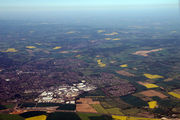
Hemel Hempstead grew up in a shallow chalkland valley at the confluence of the rivers Gade and Bulbourne, 27 miles (43 km) north-west of central London.
The main railway line between London Euston and the Midlands passes through Apsley and Hemel Hempstead railway stations a mile south of the town centre, as does the Grand Union Canal. These links, as well as the A41 trunk road, follow the course of the River Bulbourne river valley. The New Town expansion took place up the valley sides and on to the plateau above the original Old Town. In the 1990s, a motorway-style bypass numbered A41 was built to the south and west of the town across the upland chalk plateau, which does not follow the lie of the land. Hemel Hempstead is also linked to the M1 motorway to the east. The M25 is a few miles to the south. To the north and west lie mixed farm and woodland with scattered villages, part of the Chiltern Hills. To the northwest lies Berkhamsted. To the south lies Watford and the beginnings of the Greater London conurbation. To the east lies St Albans, a historic cathedral and market town and now like Hemel Hempstead, part of the London commuter belt. Possibly the best view of Hemel Hempstead in its physical setting is from the top of Roughdown Common, a chalk hill to the south of the town, at TL 049 055.
Climate
Hemel Hempstead experiences an oceanic climate (Köppen climate classification Cfb) similar to almost all of the United Kingdom.
| Climate data for Hemel Hempstead | |||||||||||||
|---|---|---|---|---|---|---|---|---|---|---|---|---|---|
| Month | Jan | Feb | Mar | Apr | May | Jun | Jul | Aug | Sep | Oct | Nov | Dec | Year |
| Average high °C (°F) | 6 (43) |
7 (45) |
10 (50) |
12 (54) |
16 (61) |
19 (66) |
21 (70) |
22 (72) |
18 (64) |
14 (57) |
9 (48) |
6 (43) |
13 (55) |
| Average low °C (°F) | 3 (37) |
3 (37) |
4 (39) |
5 (41) |
8 (46) |
10 (50) |
12 (54) |
13 (55) |
11 (52) |
8 (46) |
5 (41) |
3 (37) |
7 (45) |
| Precipitation mm (inches) | 69.3 (2.728) |
59.4 (2.339) |
46.5 (1.831) |
70.1 (2.76) |
58.1 (2.287) |
58.9 (2.319) |
46.0 (1.811) |
68.9 (2.713) |
51.7 (2.035) |
84.3 (3.319) |
93.9 (3.697) |
80.9 (3.185) |
788.0 (31.024) |
| Source: [11] | |||||||||||||
Neighbourhoods in Hemel Hempstead
The grand design for Hemel Hempstead newtown saw each new district centred around a parade or square of shops called a neighborhood centre. Other districts existed before the newtown as suburbs, villages and industrial centers and were incorporated into the town.
- Adeyfield — Located on a hill to the east of the old town, this was the first of the New Town districts to be started. The first four families of Hemel Hempstead’s new town moved into their homes in Adeyfield on Wednesday, 8 February 1950.
- Apsley — a nineteenth century mill town a mile south of old Hemel which grew up around the paper making industry — notably the John Dickinson Stationery mills. Now a suburb of Hemel with many warehouse outlets set in Retail parks and a large Sainsbury's Supermarket.
- Bennetts End — Located on the rising ground to the south east and another original district of the new town. Construction began in 1951 and by autumn 1952 300 houses were occupied.
- Boxmoor — A mostly Victorian era developed district to the southwest which grew up because of its proximity to the London Midland and Scottish Railway station and trains to London.
- Chaulden — an early new town district, west of the town, commenced in 1953 with its own neighbourhood shopping centre.
- Corner Hall — an estate adjacent to the plough roundabout frequently thought to be part of Apsley. Bounded by Lawn lane and St Albans Hill.
- Cupid's Green — a sixties estate north east of the town on the site of the old fireworks factory.
- Felden — Felden is a partly rural area south west of Hemel Hempstead that has many wealthy detached houses. It is home to the national headquarters of the Boys' Brigade.
- Gadebridge — A later 1960s development located north west of the old town.
- Grovehill — Grovehill is a housing estate towards the northern edge of Hemel Hempstead. It was developed as part of the second wave of development of the New Town commencing in 1967 and completed in stages by the early 1980s. Within the estate there are such features as 'Henry Wells Square' containing local shops, off licences, a pub, a 12 table snooker club. The estate also contains 'Grovehill Community Centre', the local 'Grovehill Playing Fields', home to many football (soccer) pitches, a baseball ground and changing facilities. Grovehill also incorporates various churches, a doctor's surgery and a dental surgery as well as several schools including The Astley Cooper School.
- Highfield — a district of the original new town located north of the old town.
- Leverstock Green — A village 4 km east of the old town which pre-existed the new town and which has now been subsumed into it, although retaining its original village centre. It was once a popular place for actors and artists to live.
- Nash Mills — a historic name for a district beside the River Gade downstream and southeast of the town which had water mills present since at least the in the 11th century. It is now a mix of industrial use and housing from the nineteenth century through to small modern developments.
- Warner's End — an original new town residential district on chalk upland to the west of Hemel Hempstead where work commenced in 1953.
- Woodhall Farm — A housing estate on the north eastern edge of town towards Redbourn. Woodhall Farm was built in the mid to late 1970s on the former Brock's Fireworks site with a mix of private and housing association stock. Built by Fairview Estates it has property ranging from four-bedroom detached houses down to one bedroom low-rise flats. The area has a shopping centre with a Sainsbury's, Newsagents, Takeaway and Off-licence. It also has two infant schools and middle schools and a doctors surgery serving the local area.
Developments since the new town
The Jarman Park leisure centre was opened in 1994, containing eight film screens run by Empire Cinemas (previously Odeon Cinemas), ten pin bowling (Hotshots), an ice rink (Planet Ice, originally Silver Blades), a water park (Aqua Splash) and night clubs (Lava and Ignite). This development, and those of the adjacent McDonalds restaurant and Tesco superstore, were built on land originally donated to the town for recreational purposes. Land has also been reserved for a hotel, but to date (April 2009) this remains derelict. Replacement openspace was created to the east of the town, near Leverstock Green, Longdean Park and Nash Mills.
The former John Dickinson Stationery mills site, straddling the canal at Apsley, was redeveloped with two Retail parks, a Sainsbury supermarket, 3 low rise office blocks, housing, a mooring basin, and a hotel. A further office block is planned. Some buildings have been retained for their historic interest and to provide a home for the projected Paper Museum.
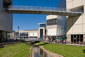
An indoor shopping mall was developed adjacent to the south end of the Marlowes retail area, and in 2005 the Riverside development designed by Bernard Engle Architects was opened, effectively extending the main shopping precinct towards the Plough roundabout. The new centre includes several outlets for national retailers including Debenhams, Starbucks, HMV, Waterstones, and more. These two developments have moved the "centre of gravity" of the retail centre away from the traditional market and the north end of Marlowes has become an area for secondary outlets.
Further extensive redevelopment of the northern end of Marlowes has recently (October 2007) been given the green light and is scheduled to be complete by 2013.
Isle of Man based residential developer Dandara is currently redeveloping the former Kodak headquarters into a residential development to be known as "Image".
Since the 2005 Buncefield fire the former Maylands Avenue factory estate, badly affected by the fire, has been re branded as Maylands Business Park and a 40 tonne sculpture by Jose Zavala called Phoenix Gateway placed on the first roundabout off the M1 to symbolise its renewall.
The now disused mill site at Nash Mills is to be redeveloped. Proposals have been publicised (2008) to build housing and community facilities, retain some historic buildings and use various watercourses as amenities.
Sport
A wide range of sports and physical activities are catered for within the town and its immediate locality. Most sports facilities in the town, and the wider borough, are provided through Sportspace (the operating name of Dacorum Sports Trust). They have operated several facilities including a Sports Centre, Swimming Pools and Running Track previously run by Dacorum Borough Council and others sited at schools, since April 2004. Dacorum Sports Trust is a non-profit company limited by guarantee and a registered charity managed by a Board of Trustees. Surpluses (profits) are reinvested into sports facilities.[12]
In sport Hemel Hempstead has several representative teams.
Hemel Hempstead Town football club dates back to 1885 and now play in the Southern Football League Premier Division. Nicknamed The Tudors, they play at Vauxhall Road in the Adeyfield area of the town; this was the site of the former sports club for the employees of Brocks Fireworks. There are, of course, many amateur sides throughout the town.
The Camelot Rugby Club plays Rugby Union and it is one of the oldest clubs in England, being founded in 1919. The club's home ground is in Chaulden.[13] Hemel Stags, founded in 1981, are the only rugby league team from the South of England to play in the Rugby League Conference National league.
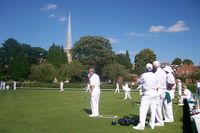
Hemel Hempstead Town Cricket Club, founded in 1850, has a pitch and practice facilities at Heath Park, near the town centre. The Boxmoor Cricket Club, founded in 1857, have a ground nearby on Blackbirds Moor. At Leverstock Green, there is the eponymously named Leverstock Green Cricket Club.
Hemel Hempstead has several swimming clubs the most notable of which is Hemel Hempstead Swimming Club, the town also has FIFOLITS Swimming club and also boasts a swimming squad Dacorum Borough Swimming Squad which brings together the best swimmers in the Borough.
The Hemel Ski Centre has been replaced in 2008/09 by The Snow Centre, a real snow indoor sports venue which, opened in April 2009, has had previews for invited guests in early May.[14]
Dacorum Athletic Club is based at Jarmans Park. Hemel Hempstead Bowls Club has its greens at Gadebridge Park.
Gadebridge Park also has an outdoor skatepark that was designed and supplied by local extreme sports fanatics "Hemel Skates" after earning ₤65,000 through fundraising.
Leverstock Green Tennis Club provides courts and coaching for members and other courts are available in public parks. There are private indoor facilities at Hemel Indoor Tennis Centre at Abbot's Hill School, Nash Mills.
The local authority (Dacorum Borough Council) provides the infrastructure for several of the sports mentioned above. In addition, there is a sports centre at Boxmoor and shared public facilities at a number of secondary schools, provided via Sportspace. These provide multi-purpose courts (badminton, basketball, etc.), gymnasia and swimming pools. There are also private, member only gymnasia.
There are two 18-hole golf courses just outside the south western edge of the town. One is in the grounds of Shendish Manor and the other, Little Hay is off Box Lane, on Box Moor Trust land. There is also a nine hole course (Boxmoor) also located on Box Lane.
Schools
There are six state maintained secondary schools in the town:
- Adeyfield School — Business and Enterprise College
- Astley Cooper School — A Specialist College for the Visual Arts.
- Cavendish School — A Specialist Sports College
- The Hemel Hempstead School — A Specialist Performing Arts School
- John F Kennedy Catholic School — A Specialist Technology and Modern Foreign Languages College (Roman Catholic)
- Longdean School — A Maths and Computing College
There are also independent (fee-paying) schools in, or adjacent, to the town:
- Lockers Park School, a day and boarding school for boys aged 5–13
- Abbot's Hill School, a day and boarding school for girls
- Westbrook Hay School, a co-educational school for children aged 3–13
In addition there is a West Herts College Campus based in the town centre.
In 2006, the local education authority has judged that there are too many primary school places in the town and has published proposals to reduce them.[15] The options involved school amalgamations and closures. A list of schools taking children of primary age is at Primary schools in Dacorum.
Political representation
Hemel Hempstead returns its own MP at Westminster as the Hemel Hempstead parliamentary constituency. At the May 2005 General election the seat changed from Labour to Conservative. Mike Penning, (Conservative), was elected with a majority of 499, just over 1%.[16] In May 2010 Mike Denning was again returned as MP taking 50% of the vote with an increased majority of 13,406.[17] The previous MP was Tony McWalter, (Labour Co-operative), first elected 1997.
Twinned towns
Hemel Hempstead, as part of the Borough of Dacorum, is twinned with:
 Neu-Isenburg, Germany
Commerce, industry and agriculture
Historical
Historically, the area was agricultural and was noted for its rich cereal production. The agricultural journalist William Cobbett noted of Hemel Hempstead in 1822 that "..the land along here is very fine: a red tenacious flinty loam upon a bed of chalk at a yard or two beneath, which, in my opinion, is the very best corn land that we have in England."[18] By the 18th century the grain market in Hemel was one of the largest in the country. In 1797 there were 11 watermills working in the vicinity of the town.[19]
The chalk on which Hemel is largely built has had commercial value and has been mined and exploited to improve farmland and for building from the 18th century. In the Highbarns area, now residential, there was a collapse in 2007 of a section of old chalk workings and geological studies have been undertaken to show the extent of these workings.[20]
In the 19th century, Hemel was a noted brickmaking, paper manufacturing and straw-plaiting centre. In later nineteenth and early twentieth centuries, Hemel was also a noted watercress growing area, supplying 1/16th of the country's national demand — following development of the New Town, the watercress growing moved to nearby Berkhamsted and Tring. The cress beds were redeveloped as the modern-day Water Gardens.
Joseph Cranstone's engineering company was founded in 1798, and was responsible for much of the early street lighting in the town as well as it first gasworks. It became the Hemel Hempstead Engineering Company and stayed in business until World War II . In 1867 Cranstone's son built a steam powered coach which he drove to London, but which was destroyed in a crash on the return journey. A local Boxmoor pub commemorates the event.
In 1803 the first automatic papermaking machinery was developed in Hemel by the Fourdrinier brothers at Frogmore. Paper making expanded in the vicinity in the early nineteenth century and grew into the huge John Dickinson mills in the twentieth.
A traditional employer in the area was also Brock's, manufacturer of fireworks. The factory was a significant employer since well before World War II, and remained in production until the mid-1970s. The present-day neighbourhood of Woodhall farm was subsequently built on the site.
Significant historic local firms:
- Addressograph, address labels & labelling systems
- Apple Computer's UK operations were originally based in Hemel, though they moved to much larger premises in Uxbridge during the late 1980s.
- British Petroleum.
- Brocks Fireworks, Firework manufacturer
- Crosfield Electronics — digital imaging systems, now part of FFEI Ltd.
- Hemel Hempstead Evening Post-Echo, then part of Thomson Regional Newspapers and one of the few nightly regional newspapers
- John Dickinson and Sons, paper manufacturing
- Kodak.
- Lucas Aerospace — relocated (as TRW Aeronautical Systems) to Pitstone in 2002.
Present day
Hemel Hempstead has a mixture of heavy and light engineering companies and has attracted a significant number of information technology and telecommunications sector companies helped by its proximity to London and the UK motorway network. However, (and again in common with many new towns) it has a much narrower business base than established centres, particularly Watford and St Albans.
Significant firms with a local presence include:
- 3Com, Telecommunications equipment
- ACT (formerly Apricot Computers)
- Aquascutum, Clothing manufacturer
- ASOS.com, UK's largest online fashion retailer
- Bourne Leisure
- BP Oil, petroleum
- BSI Product Services
- Gist Food distribution for Marks & Spencer
- Glanville Consultants, Civil and Structural Engineering Consultants.
- British Telecom, telecommunications
- BSI (British Standards Institution) materials testing
- Steria (formerly Bull (formerly Honeywell)), computers
- DSG International plc (formerly Dixons Group), electrical retailer (global headquarters)
- Dixons, electrical retailer (national headquarters)
- DuPont, petrochemicals
- Epson, Consumer Electronics
- Friedheim International, pre- and postpress printing & bookbinding equipment
- Filippo Berio UK Olive Oil The subsidiary of the n.1 Italian Brand in Olive Oil
- Hewitt Associates, Human resources (personnel) out-sourcing organisation
- HSBC Bank, Telephone services & Head Office Operations
- Kent Brushes Or, to use their full title, G B Kent & Sons Ltd — Established in 1777 & has been manufacturing brushes in Apsley for most of that time.
- Kodak, photography — (In March 2005 Kodak announced that it would vacate its central headquarters tower block in Hemel, and will be located on 3Com Campus in Hemel)
- NEXT, clothing (distribution centre)
- Northgate Information Solutions , specialist software for human resources
- Sappi group, paper, at Nash Mills. Has announced the mill will close in 2006
- Steria, IT services
- Unisys, computers
- Xerox Office Supplies, Document supplies, paper development
Hemel's notable features
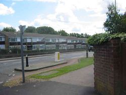
Hemel is famous (or perhaps notorious) for its "Magic Roundabout" (officially called the Moor End roundabout, or "The Plough Roundabout" from a former adjacent public house), an interchange at the end of the new town (Moor End), where traffic from six routes meet. Traffic is able to circulate in both directions around what appears to be a main central roundabout (and formerly was such), with the normal rules applying at each of the six mini-roundabouts encircling this central reservation. It is a misconception that the traffic flows the 'wrong' way around the inner roundabout; as it is not in fact a roundabout at all, and as such no roundabout rules apply to it. It was the first such circulation system in Britain.
Hemel claims to have the first purpose built multi-storey car park in Britain. Built in 1960 into the side of a hill in the Marlowes shopping district, it features a giant humorous mosaic map of the area by the artist Rowland Emett.
The new town centre is laid out alongside landscaped gardens and water features formed from the River Gade known as the Watergardens designed by G.A. Jellicoe. The main shopping street, Marlowes, was pedestrianised in the early 1990s.
Hemel also was home of one of the first community based television stations West Herts TV which later became Channel 10.
For many years the lower end of Marlowes featured a distinctive office building built as a bridge-like structure straddling the main road. This building was erected on the site of an earlier railway viaduct carrying the Hemel to Harpenden railway, known as The Nicky Line. When the new town was constructed, this part of the railway was no longer in use and the viaduct demolished. The office building, occupied by BP, was designed to create a similar skyline and effect as the viaduct. In the early 1980s it was discovered that the building was subsiding dangerously and it was subsequently vacated and demolished. Adjacent to BP buildings was a unique double-helix public car park. The lower end of Marlowes was redeveloped into the Riverside shopping complex, which opened on 27 October 2005. Retailers taking residence at the Riverside complex, include Debenhams and HMV.
A few hundred metres away, overlooking the 'Magic Roundabout', is Hemel's tallest building; the 19-storey Kodak building. Built as the Kodak company's UK HQ the tower was vacated in 2005. It was then temporarily reoccupied in 2006 after the Buncefield explosion destroyed Kodaks other Hemel offices. It is now being converted into 434 apartment homes.[21]
The Heathrow airport holding area known as the Bovingdon stack lies just west of the town. On a clear day, at peak times, several circling aircraft can be visible.
The national headquarters of the Boys' Brigade is located at Felden Lodge, near Hemel.
A series of 10m high blue steel arches called the Phoenix Gateway has been installed on the roundabout closest to the Hemel Hempstead junction of the M1 motorway. The aim is to regenerate the town after the Buncefield explosion with a striking piece of commercial art. It is Funded by the East of England Development Agency.[22]
Notable people
Notable people associated with the town in order of birth date:
- Nicholas Breakspear (c. 1100–1159), the only English Pope (Adrian IV 1154-1159) was born in nearby Bedmond, a village between Hemel and Abbots Langley.
- Richard Field (1561–1616) a theologian associated with the founding of the Anglican Church, was born in Hemel Hempstead.
- Sir Francis Bacon (1561–1626) was lord of the manor of Gorehambury which included Hemel Hempstead from 1601.
- Robert Snooks (c. 1761-1802) England's last highwayman to be executed and buried at the scene of his crime lies here.
- Sir Astley Cooper (1768–1841) English surgeon and anatomist. Lived at Gadebridge House, the grounds of which are now a public park.
- John Dickinson (1782–1869), inventor and founder of the paper mills at Apsley & Nash Mills which evolved into John Dickenson plc, built and lived at Abbots Wood, Nash Mills.
- Sir Arthur Evans, , (1851–1941) archaeologist, was born at "The Red House", Nash Mills.
- Lyn Harding (1867–1952) actor and film star lived at a house called Logandene in Tile Kiln Lane, Leverstock Green, Hemel Hempstead.
- Prince Maurice of Battenberg (1891–1914), grandson of Queen Victoria was a student at Lockyers Park School.
- Louis Mountbatten, 1st Earl Mountbatten of Burma (1900–1979), admiral , statesman and an uncle of the Duke of Edinburgh, was a student at Lockyers Park School.
- Guy Burgess, (1911–1963), Russian spy, was a student at Lockyers Park School.
- Salem Hanna Khamis (1919–2005) was a Palestinian economic statistician for the United Nations Food and Agriculture Organization who helped formalise the Geary-Khamis method of computing purchasing power parity of currencies. In later life lived in Hemel Hempstead and died there.
- Roger Moore, (born 1927) actor, famous for his roles as The Saint and James Bond, lived in Tile Kiln Close, Leverstock Green, Hemel Hempstead in the 1960s.
- Christopher Trace (1933–1992) first presenter of BBC TV's Blue Peter children's show lived for a time in Blacksmiths Row, Leverstock Green.
- Bill Morris OJ (born 1938), former leader of the TGWU, lived in Hemel Hempstead and still lives within the Borough of Dacorum.
- Michael Bradshaw (1933–2001) English/Canadian actor grew up in Boxmoor from 1938 until the mid-50s
- The Nawab of Pataudi, (b 1941) captain of the Indian Cricket team, was a student at Lockyers Park School.
- Paul Boateng, (born 1951) Britain's first black Cabinet minister and Ambassador to South Africa, attended Apsley Grammar School (now part of Longdean School). He first stood for Parliament in Hemel Hempstead's constituency.
- Dave Vanian (born 1956)(real name David Letts), the lead singer of The Damned, was born and lived in Chaulden.
- Ian Lygo, famous for his record-breaking 75 consecutive wins on UK Quiz show 100%, lives in Hemel Hempstead.
- Vinnie Jones, (born 1965) footballer and actor, is a local resident.
- Steven Wilson, (born 1967) multi-instrumental musician, singer, songwriter and producer was raised here from age 6 after his family moved from London. His band Porcupine Tree was also formed in Hemel Hempstead around the year 1987. His home studio "No-Mans Land" is located here.
- Claire Skinner (born 1965) the distinguished actress was born (1965) and raised in Hemel Hempstead.
- Oliver Low (born 1970) in Hemel Hempstead a poet, software engineer, composer, games designer and author.
- Colin Edwin (born 1970) Bass player with Porcupine Tree was educated and lived in Hemel Hempstead.
- Luke Donald, (born 1977) was born in Hemel Hempstead. He is a golfer who plays mainly on the US based PGA Tour.
- Marc Bircham, (born 1978) currently lives in Hemel Hempstead near the Shendish estate. He is a retired Canadian footballer who played for QPR. Millwall FC and Yeovil Town FC. He has also figured in the Canada men's national soccer team.
- Anthony Davidson, (born 1979) Formula One driver was born here. Formula One drivers Christian Klien and Vitantonio Liuzzi live in Apsley.
- Tommy W. Smith, (born 1980) was born in Hemel Hempstead. He is a footballer who currently plays for Portsmouth FC in the Premier League.
- Chris Pig (born 1965) is an internationally respected master printmaker, lived in Hemel Hempstead and attended Longdean School.
- Lee Grant, (born 1983), an English footballer, currently playing as goalkeeper for Sheffield Wednesday.
- Chris Eagles, (born 1985) footballer for Burnley in the Premier League is from Hemel Hempstead.
- Jordan Parkes,(born 1989), an English footballer, currently playing for Barnet, is from Leverstock Green.
- Theo Walcott, (born 1989),an English footballer, currently lives with his family in the Hemel Hempstead area.
Film and television production
Pie in the Sky (a BBC police drama) was filmed here. At one point, the site for the restaurant was a florist but is currently a shop selling Dolls Houses. A nearby restaurant changed its name to Pie in the Sky for a short time while the series was popular.
Birthday Girl (a 1998 film starring Nicole Kidman and Ben Chaplin) features Hemel Hempstead prominently during scenes showing the main character going to and from his place of work (a fictional bank somewhere in Bank Court). However scenes shown in the parking garage and the side streets show St Albans.
A film version of the TV series Till Death Us Do Part was filmed in part around the town.
The Old Town appeared for a few seconds in the Oasis soft drink 'Fruity drinks and lunchtime dreams' TV commercial first aired in 2010 – the moving sandwich shop rolls down High Street.[23]
Art and photograph gallery
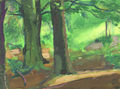 The woods at Cupid's Green, painted by Ashley George Old in 1959 |
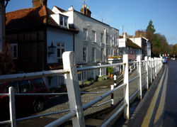
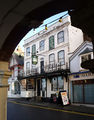 The Old Bell pub in Hemel old town has parts built in 1615 but is on the site of even older inns. Contains some unusual French wallpaper dating back to 1821, which has been cleaned by the Victoria & Albert Museum. |
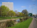 This 1971 office block formed Kodak's European HQ until closed in 2006. It is currently (2010) being converted into flats. In the foreground is the River Gade and to the right a road sign for the 'Magic Roundabout'. |
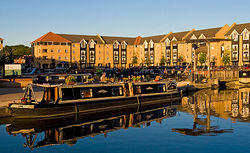
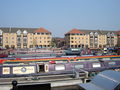 Apsley Lock Marina, Hemel Hempstead, built in 2003. |
 The Church of St Mary's (1871) stands above the modern Sainsburys supermarket in Apsley. |
 Northeast side of The Magic Roundabout, Hemel Hempstead. The "roundabout" is a series of 6 mini roundabouts spaced around a larger closely looped circulation system. |
See also
- The Museum of Technology
References
- ↑ Origin of the name, Hertfordshire Genealogy, UK. Accessed June 2006.
- ↑ Rye, James (7 May 2009). "Norfolk and Suffolk Place-Names". The Larks Press. pp. see "-stede". http://www.englishplacenames.co.uk/. Retrieved 8 January 2010.
- ↑ Susan Yaxley
- ↑ "A Key to English Place-Names Hemel Hempstead". Institute for Name-Studies,. School of English Studies, University of Nottingham,. http://www.nottingham.ac.uk/~aezins/kepn/detailpop.php?placeno=4591. Retrieved 8 January 2010.
- ↑ A History of Roosevelt, Roosevelt Union Free School, Hempstead, Nassau County, New York, USA. Accessed January 2010.
- ↑ Wright, George Newenham (1836). A new and comprehensive gazetteer, Volume 3. T. Kelly,. p. 382. http://books.google.co.uk/books?id=DiQDAAAAYAAJ&dq=Muresley%20Priory&pg=PA382#v=onepage&q=hempstead&f=false.
- ↑ Dacorum Heritage Trust
- ↑ The Chiltern Canal Corridor Castle Wharf project Berkhamsted. Accessed April 2007
- ↑ Yaxley, page 264
- ↑ "Buncefield tank 'was overflowing'". BBC News. 9 May 2006. http://news.bbc.co.uk/1/hi/uk/4752819.stm. Retrieved 5 June 2007.
- ↑ "Averages for Hemel Hempstead". http://weather.msn.com/monthly_averages.aspx?wealocations=wc:UKXX0527&q=Hemel+Hempstead%2c+GBR+forecast:averagesm.
- ↑ "About us". Dacorum Sports Trust. 2007. http://www.sportspace.co.uk/default.asp?step=2&id=1. Retrieved 28 September 2009.
- ↑ Camelot website
- ↑ Ski centre gets go-ahead Hemel Hempstead Gazette, , 15 December 2006
- ↑ "Hemel Hempstead Review of Primary School Places". Hertfordshire County Council. September 2006. http://www.hertsdirect.org/infobase/docs/pdfstore/hemhemp06.pdf. Retrieved 10 January 2008.
- ↑ "BBC News — Result: Hemel Hempstead". 6 May 2005. http://news.bbc.co.uk/1/shared/vote2005/html/310.stm. Retrieved 17 May 2009.
- ↑ "BBC News — Result: Hemel Hempstead". 6 May 2010. http://news.bbc.co.uk/1/shared/election2010/results/constituency/c12.stm. Retrieved 2 August 2010.
- ↑ http://www.visionofbritain.org.uk/text/chap_page.jsp?t_id=Cobbett&c_id=8&p_id=573#pn_8 visionofbritain.org.uk
- ↑ http://www.hertfordshire-genealogy.co.uk/data/directories/directories-hemel-1797-des.htm hertfordshire.co.uk
- ↑ "About the chalk mines". Dacorum Borough Council. 2008. http://www.dacorum.gov.uk/default.aspx?page=5692. Retrieved 23 November 2008.
- ↑ Council go-ahead for former Kodak site after cut in number of homes Hemel Hempstead Gazette, 4 April 2007 . Accessed August 2007
- ↑ Name for new Maylands sculpture Hemel Hempstead Gazette, 30 May 2007 . Accessed August 2007
- ↑ Oasis commercial, YouTube.
Further reading
- Edwards, Dennis F.(1994) Hemel Hempstead in old picture postcards European Library, ISBN 90-288-5797-4.
- Hemel Hempstead Directory of 1797 — Early description of the town at Hertfordshire Genealogy. Retrieved November 2009
- Description of Hemel Hempstead (1870–72), John Marius Wilson, Imperial Gazetteer of England and Wales.[1]
- Yaxley, Susan; and others (1973, reprinted 1981). History of Hemel Hempstead. Amplion Press: Hemel Hempstead Local History and Records Society. ISBN 0-9502743-0-5.
- Buteux, Elizabeth (2005). Hemel Hempstead — A History and Celebration. Salisbury, Wiltshire: The Francis Frith Collection. ISBN 1-84589-206-2.
- Hastie, Scott; Fletcher , Lynne (1997). Hemel Hempstead — The Story of New Town Development. Dacorum Borough Council. ISBN 0951153927.
Footnotes
"How historic treasures have devalued a house", Sunday Times, 12 November 2000 by Chris Partridge; p. 15
External links
- Dacorum Borough Council Local authority pages on Hemel Hempstead.
- Hemel Web Community web page.
- Hemel on-line Hemel Hempstead community website.
- Photo gallery showing redevelopment of Kodak building
- Hemel Hempstead Local History & Museum Society
- Map of Hemel Hempstead in 1883 from old-maps.co.uk
- Photos of Hemel and surrounding area Indexed by OS grid square at www.geograph.co.uk
- A Brief History of Hemel Hempstead A Blog on Hemel Hempstead's local history.
- Berkhamsted and Hemel Hempstead Hockey Club
- Maylands Business Park
- Hemel Hempstead Swimming Club
- Boho Boxmoor The online magazine for Boxmoor and Hemel Hempstead people.
|
||||||||||||||